Energy news from Omaha Public Power District
Energy news from Omaha Public Power District
These tips can help you stay safe during severe weather
The end of March marks the beginning of spring and an increased potential for a severe weather.
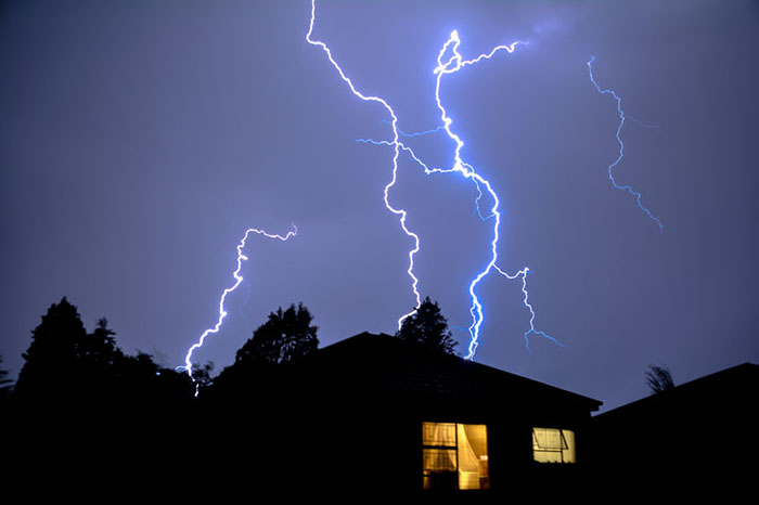
Our area sees its share of dramatic weather, including severe thunderstorms, flash floods, tornadoes and spring snowstorms.
The National Weather Service (NWS) wants everyone to be prepared for bad weather and has a variety of tips to mark Severe Weather Awareness Week, March 23-27, in Nebraska.
It’s the perfect time to ensure that your family knows how to respond to severe weather and where to seek shelter. This is also a good week to make sure you have a disaster preparation kit stowed in your place of shelter.
And because severe weather can cause power outages, it’s also important to have a plan in place for staying with family or friends should you lose power and need it for medical equipment for yourself or a loved one.
Blizzards
When you think of a blizzard, you might think of a strong winter storm that drops a large amount of snow. The NWS defines a blizzard as:
- A storm that contains a large amount of snow, OR
- Blowing snow lasting three hours or more with winds in excess of 35 mph winds and less than a quarter-mile of
Some effects of snowstorms and blizzards can be life-threatening. Blowing snow can create conditions with low to zero visibility. And flash freezing can occur on roads when temperatures drop suddenly and wet roads freeze. Both of those conditions can make travel perilous if not impossible.
Strong winds and low temperatures together can cause dangerous wind chills that could lead to frostbite or hypothermia. The NWS advises against traveling or spending time outdoors when wind chills are dangerously low.
Thunderstorms
What is a “severe” thunderstorm? The NWS applies specific criteria to storms of this level.
A thunderstorm is severe when it produces:
- Quarter-size hail 1-inch or larger in diameter
- Winds of at least 58 mph
- A tornado
Thunderstorms can result in damage caused by wind, hail, lightning, flooding and flash flooding, and tornadoes.
Tornadoes
Tornadoes can strike at any time of day, on any day of the year. Be prepared by following these tips:
- Have a plan of action before severe weather strikes. You need to respond quickly when a warning is issued or a tornado is spotted.
- Know how your community sends weather warnings. Some use outdoor sirens, while others depend on media and smartphones to alert residents.
- Pick a tornado-safe room in your home, such as a basement, cellar or interior room on the lowest level with no windows. Ensure all members of your family know what to do in a severe weather situation.
- After a tornado hits, contact loved ones to let them know you are safe. Look out for your neighbors. If you come across an injured person and are properly trained, render first aid until emergency response teams arrive. And stay informed: Multiple rounds of storms are possible during severe weather outbreaks.
- Prepare an emergency kit to have on hand should severe weather strike.
Watches and warnings
There are two key indicators that activate weather advisories – a “watch” and a “warning.” Knowing the difference between these two terms and how to react to them is an important part of severe weather awareness and will help you stay safe.
- Watch: This means severe weather is possible. A watch is issued hours in advance. Check for forecast updates, monitor sky conditions and know where to take shelter.
- Warning: This means severe weather is imminent and is issued by local NWS forecast offices like the one in Valley. Take shelter immediately. Seek further information from media outlets and weather service announcements. You should also check for forecast updates.


Julie Wasson is the brand journalism strategist at Omaha Public Power District and the editor of The Wire. She has more than 25 years of print journalism and social media experience, including two stints at the Omaha World-Herald.
View all posts by Julie Wasson >